Views of Viniard's
| A series of prize-losing photographs display below. They are not pretty, but the photographer was amateur, and then, too, much of this terrain is not pretty. The purpose of the series is to provide a visual orientation to the movements of the Fifty-First Illinois on September 19. The link - the larger context of these pictures - reprises the views of the Viniard farm through a period map and a current aerial view of the same terrain. |
|
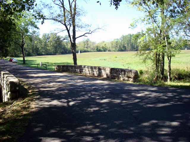
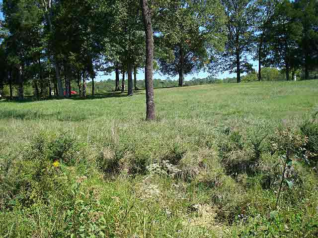
| 1. Above: The assembly area of the 51st Illinois and Bradley's Brigade. Looking west (and a little north) from the intersection of the Lafayette and Glenn-Viniard Road. Back in the woods, at the diagonal southwest corner of the west Viniard field, just beyond the red car, the brigade filed into line and then advanced across this field, the west Viniard field, from left to right in the picture, toward the Lafayette Road and the Viniard farmstead. The left-bounding road in this picture runs straight west from its intersection with the Lafayette Road along the southern boundary of the west field. The larger context of these pictures, which shows the diagonal corner of the west Viniard field and the field on the map and in an aerial view. |
|
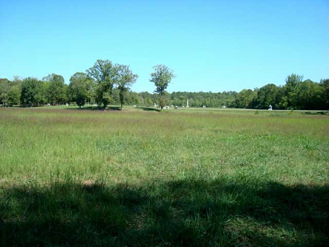
| 2. Above: This picture is taken just a few steps forward of the woods bordering the west Viniard field. One looks east across the west field (across the 300 yards to the road), across the Lafayette Road, and sees the high ground in the east Viniard field, marked by the string of monuments. The nearest trees grow where the Viniard orchard grew. The red spot toward the upper left is a red car on the Lafayette Road. The monument at far right, beyond the Lafayette Road, is the monument of the 81st Indiana. The Fifty-First Illinois monument—and those of its three sister regiments—are to the left of the 81st Indiana monument. The larger context of these pictures, again, showing the west Viniard field with its ditch and the Viniard farm, orchard to the south of the house. The "ditch" was not a regular thing. William Young of the Twenty-Sixth Ohio described it as a gully, "The gully varies in depth from 1 1/2 to 3 1/2 feet and in width from 3 to 6 or 8 feet, its border at intervals being slightly fringed with weeds and willows." |
|
| 3. Above: Looking north along the ditch from the intersection of the Glenn-Viniard and Lafayette Roads. The Lafayette Road runs north, cutting across the picture at the right side. The trees in the distance, left of the road, are around the Viniard grounds. Bradley's Brigade crossed from left to right across this terrain. The Twenty-Seventh Illinois and Forty-Second Illinois, on the right of the line, close to the photographer. The Twenty-Second Illinois and Fifty-First Illinois, on the left of the line, further in the distance toward the farmstead trees. The larger context of these pictures, again. |
|
| 4. Above: Taken in the west Viniard Field with the Lafayette Road close by on the right hand. The view is to the north and shows the low marshy ground along the ditch. The larger context of these pictures, again. The aerial view especially shows this marshy terrain. Allen Gray of the Fifty-First referred to "the marsh" when he recounted the regiment's crossing of the field. |
|
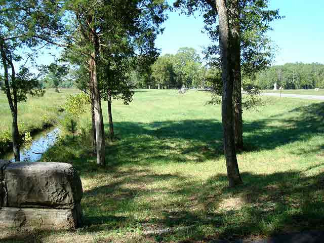
| 5. Above: Taken in the west Viniard field, looking east across the ditch in the foreground, up the incline at the Viniard yards. The red car is parked along the Lafayette Road. The incline is significant but is barely noticeable either from the road or from the west-bounding woods of the west Viniard field. The larger context of these pictures, again. |
|
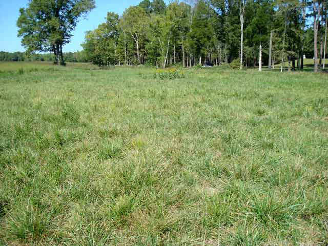
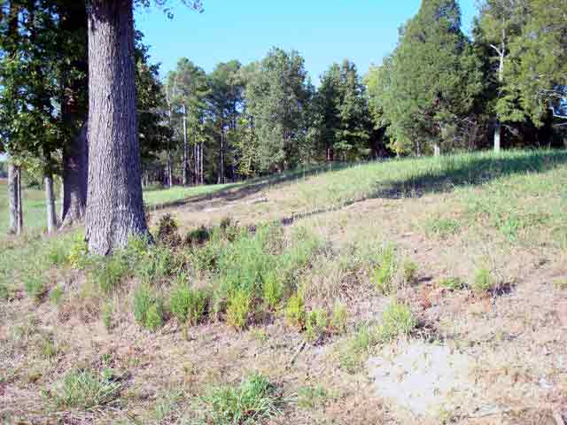
| 6. Above: Taken northward from a spot in the west Viniard field, close to Lafayette Road just out of sight on the right. This shows the incline from the ditch just out of sight on the left to the road just out of sight on the right. The larger context of these pictures, again. On the map the terrain of the photo is the northern reaches of the orchard, just south of the Viniard house. |
|
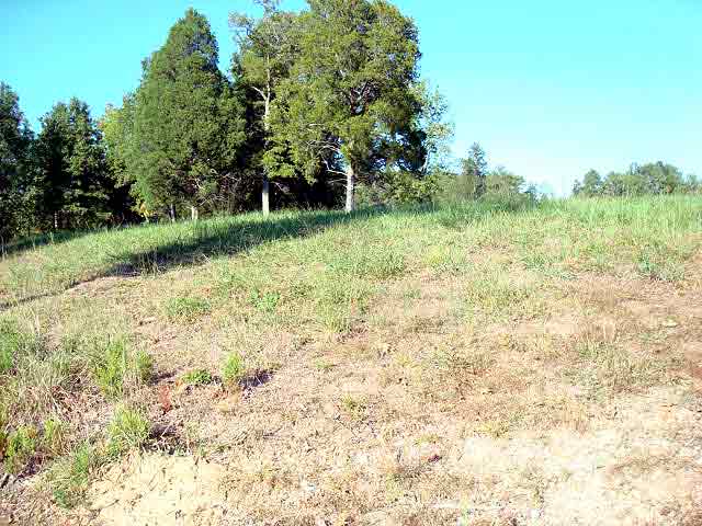
| 7. Above: A stretch of the same incline. Steeper, steep enough to require trudging—and steep enough to obscure what lies ahead. However, this incline climbs only a relatively short distance, less than 50 yards, part of the distance between the ditch and the Lafayette Road. The larger context of these pictures, again. |
|
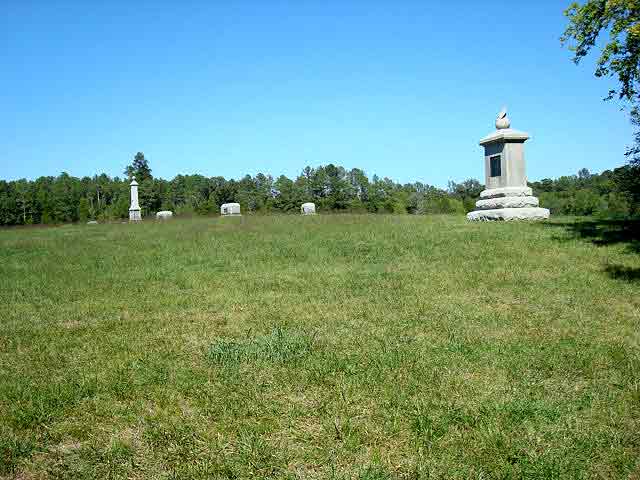
| 8. Above: The crest of the rising ground. Picture taken south of the Lafayette Road at the southern edge of the east Viniard field (near the 81st Indiana monument). The larger context of these pictures, again. The monuments at left cut across rather than lie along the axis of the crest of the rising ground. The axis runs from the center foreground half way between the monument on the right and the monuments on the left on into the distance at the trees. The trees run east-west along the far side of the Viniard-Alexander Road (except at the very right of the picture where they have started to eat into the field). You can see the relation of monuments and crest clearly in this enlarged aerial view, in which the light green swath marks the crest of the rising ground. The monuments run, irregularly, along a more north-south axis. |
|
| 9. Above: The crest of the rising ground. Similar to the picture immediately above but panning further to the right in an attempt (not very successful) to show the ground falling off toward the Confederate lines to the right (in this picture). The larger context of these pictures, again. |
|
| 10. Above: From the west Viniard field across the road into the east Viniard field. Taken south of the Viniard places. The incline here for the right wing of the brigade is much gentler than that just north of here where the left wing advanced up the incline, across the road, and into the east Viniard field. The larger context of these pictures, again. |
|
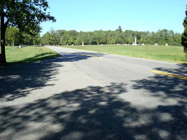
| 11. Above: From the Lafayette Road, at the south edge of the two Viniard fields where the terrain gradually drops off to a hollow; the current-day Lafayette Road is built up on a grade that makes this descent more gradual (see No. 13 below). Photo taken where the Glenn-Viniard Road, from the left, meets the Lafayette Road. In the distance, left of the road, the trees mark the Viniard homestead. On the right of the road are the monuments in the east Viniard field. In the distance, also to the right of the Lafayette Road, lies the woods north of the Viniard-Alexander Road. The larger context of these pictures, again. |
|
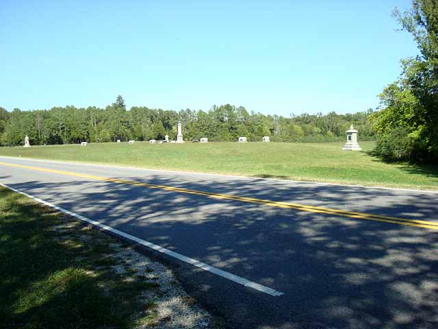
| 12. Above: A view of the east Viniard field, similar to that immediately above, except that it pans further to the right and the 81st Indiana monument comes into view at the far right. The larger context of these pictures, again. |
|
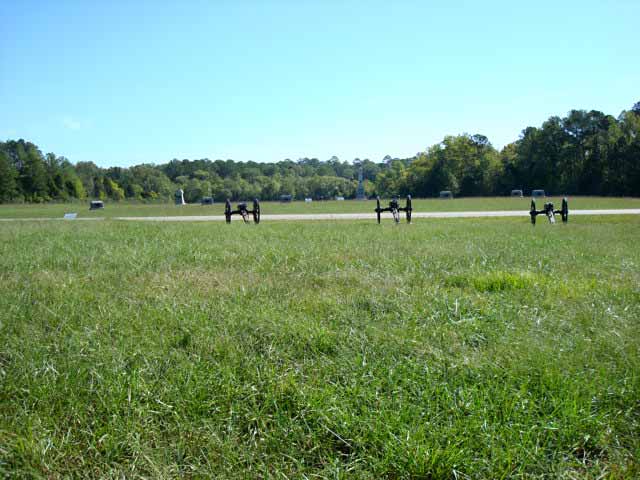
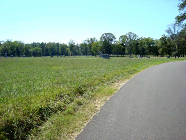
| 13. Above: Taken just east of the Lafayette Road from the hollow at the south edge of the Viniard fields, showing the incline up to the 81st Indiana position and, even more so, up to the crest of the rise. The chunky monuments belong to some of the regiments of Bradley's Brigade. The larger context of these pictures, again. |
|
| 14. Above: From the rise at the south of the east Viniard field back down toward the 81st Indiana monument. The built-up grade of the modern-day Lafayette Road shows in the distance. There was no such grade in 1863, and the road followed the descent of the terrain here. The larger context of these pictures, again. |
|
| 15. Above: From the Confederate position, from the woods north of the Viniard Alexander Road—shown here in the right of the picture—looking back toward the Viniard place, and its trees and to the west Viniard field and its bounding woods in the distance. Confederate soldiers at this point would not have been able to see through the Viniard trees on to the west as one can today. Then the trees were more extensive, thicker, and the Viniard farm buildings stood in the way. The larger context of these pictures, again. |
|
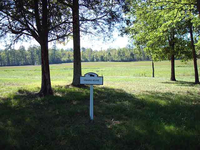
| 16. Above: From Viniard's back yard, back west across the west Viniard field, to the woods along its western reaches. Twenty-five yards beyond this sign, the descent to the ditch begins. The larger context of these pictures, again. |
|
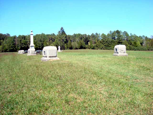
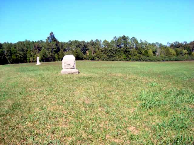
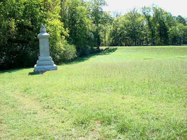
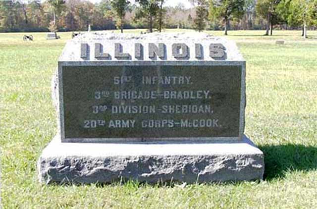
| 17. Above: The Fifty-First Illinois Monument in the east Viniard field. The picture looks rearward toward the Lafayette Road and the west Viniard field. The distant trees are about 400 yards away. |
|
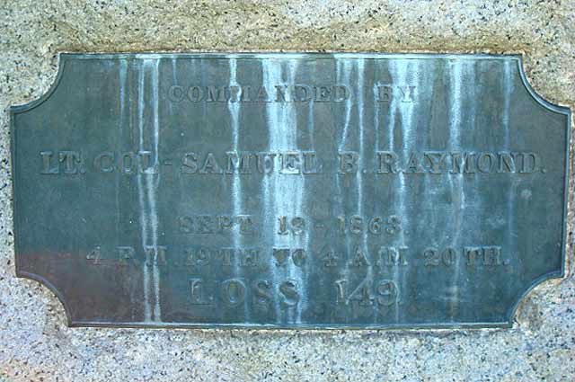
| 18. Above: The brass plaque, weathered by 110 years, on the reverse face of the regimental monument. It reads, "Commanded by Lt. Col. - Samuel B. Raymond. Sept. 19 - 1863. 4 P.M. 19th to 4 A.M. 20th. Loss 149." |