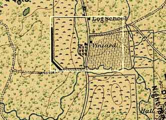
Two Maps of the Viniard Farm and Its Surroundings
|
|
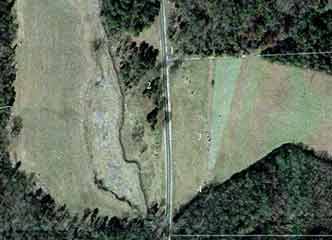
| The rectangular bounded area on the map is shown in the current-day aerial view at right. Trees have encroached on the 1863 east Viniard field, especially on the south edge. The light-colored line along the bottom of the picture east of the Lafayette Road, shows the 1863 boundary of the cultivated field. | |