The Franklin Approaches
|
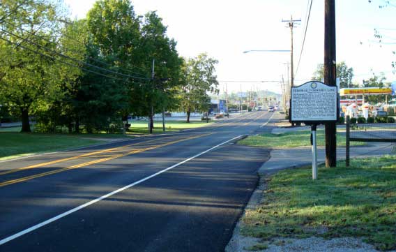
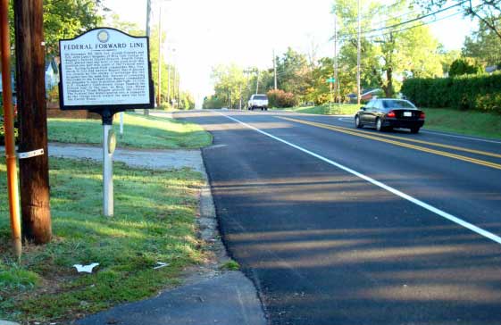
| No. 1 — Taken near the advance-line position of the Fifty-First Illinois, which was to the left of the Columbia Pike, now Columbia Ave. The interpretive sign is titled "Federal Forward Position". The view is to the south, from where the Confederate army approached. The hazy hills in the distance are two miles away. The ground slopes gradually down in front of this forward line until the ground flattens. |
|
| No. 2 - Taken from south to north, from those hills, distant two miles, in Photo No. 1 above. At about noon, Wagner's Division, including Conrad's Brigade, of which the Fifty-First was part, came down out of these hills on the retreat from Spring Hill to Franklin, crossed the low-lying flat, climbed the gentle rise toward Franklin and entrenched at the forward line. Two hours later the Confederate army took the same course, came down out of these hills toward Franklin, deployed, and attacked. At the base of the hills, the road bends left and takes its course into Franklin. |
|
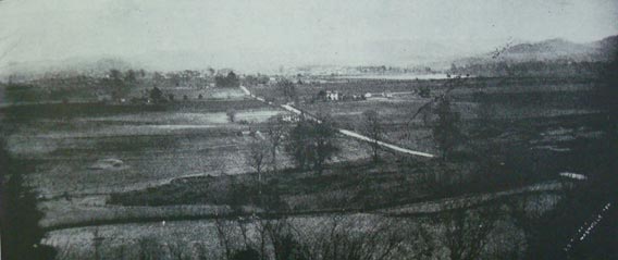
| No. 3 — Taken some years after the war but before Franklin spread south beyond its pre-war bounds. The picture shifts the view of No. 2 above to the left: it is taken from the left of the Columbia Pike from the downward slope of Winstead Hill, taken from the point where Confederate generals finalized their plan of attack. The picture gives a clear idea of the open ground of the Confederate approach and the gradual rise of the pike toward Franklin. The photo appeared in Volume 8 (1900) of the Confederate Veteran. |
|
| No. 4 — This photo looks from the center of the approaching Confederate line into the face of the Federal forward line. The photo is taken from a point one-third of a mile distant from the Federal forward line, marked by the tiny square of white (the Federal Forward Line sign) to the left of the road, in the far distance of the photo. There is a slight incline to the approach. |
|
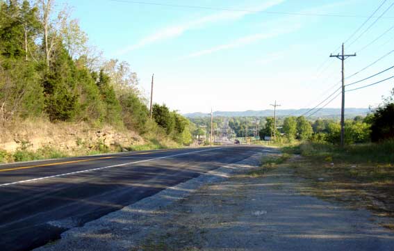
| No. 5 — Taken from the opposite side of the Federal Forward Line sign, on to the north, in the direction of Franklin, toward the main line of heavy entrenchments, about 500 yards distant. This is the first stretch of ground that the Fifty-First Illinois and other regiments at the point of the wedge traversed in their flight for "saftey." From the crest of the slope the ground fell off gently toward the main line of works. |
The Sugar Loaf Terrain
| The accounts of Merritt Atwater and John Johnson, both in command of companies of the Fifty-First Illinois on November 30, 1864 refer to the sugarloaf terrain of the ground occupied by the regiment and the other regiments of the brigade in front of the main line of fortifications south of the town of Franklin itself. John Johnson, commanding Company E, recalled, "You remember our brigade was put out in front of the main line. We had hastily thrown up some slight breastwork. The work perhaps of an hour. Co. E was placed to the left of the pike, its right resting thereon. In front of us was one of those small sugar loaf hills, rounding off in all directions. The brigade was blazing away at the masses of the rebs as they marched unfalteringly forward. E's men could not fire without doing so obliquely, the small hill hiding the foe. I went to Capt. Tilton, then in command of the Reg, asked permission to hold our fire until the jonnies came up over the knoll. He replied, "'Do as you damn please.'" | |
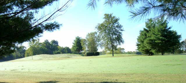 |
The hilly, sugarloaf, terrain, the photo taken at some distance. |
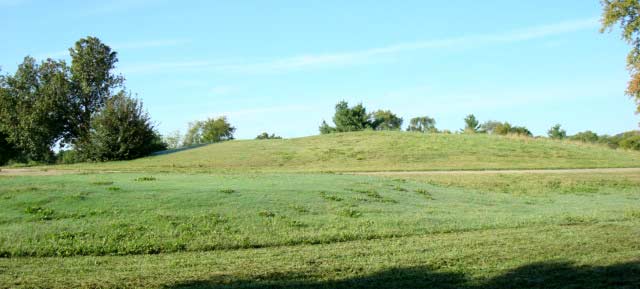 |
"Co. E was placed to the left of the pike, its right resting thereon. In front of us was one of those small sugar loaf hills, rounding off in all directions... E's men could not fire without doing so obliquely, the small hill hiding the foe." |
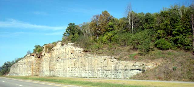 |
A road cut showing the underlying geologic formation that gives rise to the sugar loaf terrain in the Franklin area. |