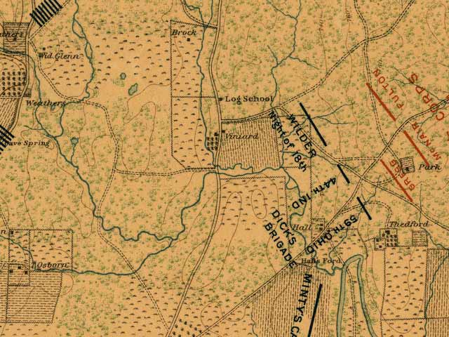
Viniard's Fields on September 18 1863 before Becoming the Theater of War. The name "Viniard" is written across the east Viniard Field. The west Viniard field is straight across the road, extending north to the marked boundary opposite the school house and west to the marked boundary. The blue-green watercourse running through the west Viniard field is "the ditch", refuge and death trap.
Source:
Atlas of Chickamauga, Chattanooga, and vicinity. Map. Chickamauga and Chattanooga National Park Commission. Washington[?], 1901. LC Civil War maps (2nd ed.), 161. American Memory. Lib. of Congress. 21 Oct. 2006 http://memory.loc.gov/cgi-bin/query/r?ammem/gmd:@filreq(@field(NUMBER+@band(g3922cm+gcw0161000))+@field(COLLID+milmap))
Note: Includes a map of the theater of operations, seven maps of the battle of Chickamauga and one of Chickamauga Park, and five maps of the battle of Chattanooga. Maps preceded by two pages of explanatory "legends" and a two-page list of the "Organization of the Union and Confederate armies at the battles of Chickamauga ... and Chattanooga ..."