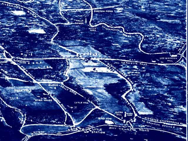
Bird's Eye View (not to scale and not showing 1863 fields and clearings): Fifty-First was positioned between the map's Glenn Hill and Lytle Hill, having approached on the Dry Valley Road at the lower right of this rendition of the ground. The Lafayette Road in the mid-distance runs north and south. Viniard farm, the Fifty-First's position on the 19th, is in the horizontal center of the map in the verticle mid-distance.
Without the interruption of having fallen into battle, the regiment with the rest of Walworth's Brigade would have continued along the Glenn-Kelly Road, angling first toward the front, then running north, parallel to the Lafayette Road, to the Federal left, a somewhat more predictable, if not safer, place to be at Noon on September 20, 1863.