Airview of Viniard Farm where Fifty-First Illinois Fought
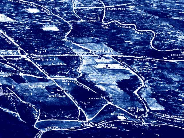
Rendition of a Birds-Eye View: Viniard Farm in the Middle
Source:
Aero view of Chickamauga and Chattanooga National Military Park (looking east). Painted by Rudolph J. Shutting. Map. Chattanooga, 1913. LC Civil War maps (2nd ed.), 159.5. American Memory. Lib. of Congress. 21 Oct. 2006 http://memory.loc.gov/cgi-bin/query/r?ammem/gmd:@filreq(@field(NUMBER+@band(g3922c+cw0159500))+@field(COLLID+milmap))