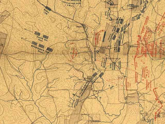
Shows positions of Lytle and Walworth as they start to move at 11:00 a.m. on September 20. Note Laiboldt just to the north of the other two of Sheridan's brigades. Lytle will fight approximately where Laiboldt is on this map, that is, where the movement arrow for Lytle points. Walworth will fight where the movement arrow for his brigade points.
To the left arrow indicates course Sheridan's three brigades, in pieces, took to the west to skirt the break in the Federal army, filled with Confederates, and rejoin it.
Source:
Atlas of Chickamauga, Chattanooga, and vicinity. Map. Chickamauga and Chattanooga National Park Commission. Washington[?], 1901. LC Civil War maps (2nd ed.), 161. American Memory. Lib. of Congress. 21 Oct. 2006 http://memory.loc.gov/cgi-bin/query/r?ammem/gmd:@filreq(@field(NUMBER+@band(g3922cm+gcw0161000))+@field(COLLID+milmap))
Note: Includes a map of the theater of operations, seven maps of the battle of Chickamauga and one of Chickamauga Park, and five maps of the battle of Chattanooga. Maps preceded by two pages of explanatory "legends" and a two-page list of the "Organization of the Union and Confederate armies at the battles of Chickamauga ... and Chattanooga ..."