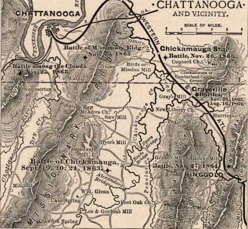
This is not an elegant map but a servicable one for beginning to locate the Fifty-First Illinois Infantry in the fighting: it shows the parallel geographic features of Chickamauga Creek and Missionary Ridge and the Lafayette Road, running between the two, unlabeled, from Lee & Gordon's Mill at the south to Rossville at the North.
Indicates the battles of Missionary Ridge, Chickamauga Station, Graysville, Chickamauga, Ringgold, and the "Battle among the Clouds," roads, railroads, towns, drainage, and relief by hachures. Scale ca. 1:310,000.
Source:
Map of Chattanooga and vicinity. [1863-1864] Prepared for and presented with compliments of Western and Atlantic R.R. Co. Buffalo, N.Y., Matthews, Northrup & Co., Art-Printing Works, [1864]
American Memory. Lib. of Congress. 03 Jan. 2007 http://hdl.loc.gov/loc.gmd/g3964c.cw0406400